The Science of Where
|
Harness the power of geospatial technologies and experience the power of place in problem-based learning. Learn how to use GIS and the Geographic Inquiry Process as instructional tools to develop students’ spatial, analytical, and problem-solving skills. GIS bridges the gap between the STEM and Humanities disciplines, providing an integrated approach to inquiry and critical thinking skills. |
|
|
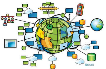
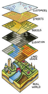
What is GIS? A geographic information system (GIS) is a computer-based system that lets us visualize, question, analyze, and interpret data to understand relationships and patterns. A broad array of industries use GIS - including business, defense, government, health services, natural resource management, and more. GIS skills are in high demand in the burgeoning information economy and easily make geography the most relevant, interdisciplinary subject in the 21st century. |
|
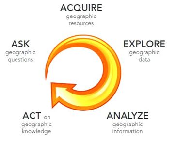
In this Academy, teachers will:
|
|
Audience: Schools interested in developing interdisciplinary problem-based learning opportunities for students using the Geographic Inquiry Process. This academy is for teachers new to GIS as well as those with GIS experience.
Dates: Participants are expected to attend all 4 academy dates. Substitutes will be paid for by the district for all four days.
Times: 8:30AM - 3:30 PM
Academy Design: Designed for interdisciplinary teams of teachers in grades 4-12. Individual teachers are still encouraged to apply if a school team is not feasible.
Where: TBD
Dates: Participants are expected to attend all 4 academy dates. Substitutes will be paid for by the district for all four days.
- October 13, 2021
- December 1, 2021
- January 19, 2022
- March 16, 2022
Times: 8:30AM - 3:30 PM
Academy Design: Designed for interdisciplinary teams of teachers in grades 4-12. Individual teachers are still encouraged to apply if a school team is not feasible.
Where: TBD
